Search:
Powered by
Website Baker
The Battle of Marmaton River (Charlot's Farm) |
| Posted by The Muse (themuse) on Sep 28 2016 |
About six or seven years ago, theCivilWarMuse published a tour to his website for sites related to the retreat of Maj. Gen. Sterling Price following his defeat at the Battle of Westport.
Originally, theMuse put the location of the Battle of Marmaton River (Charlot's Farm) near where present-day S 300 Road crosses the Marmaton River. Back in the year 2009, this crossing was a concrete ford, but that ford has recently been replaced with a new bridge.
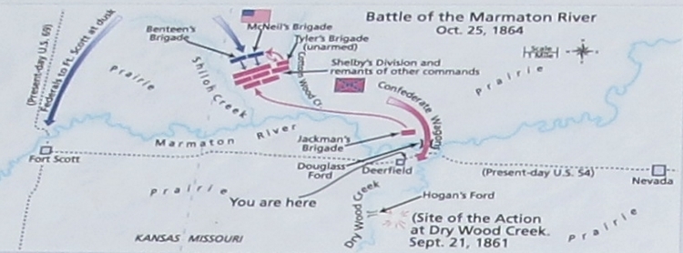
Then a few years ago, it was brought to theMuse's attention there was a new interpretive sign about this battle erected by the Missouri Department of Natural Resources. Well the map on this interpretive sign indicates the engagement took place north of the Marmaton and in between Shiloh and Cottonwood Creeks [Waypoint = 37.876597 -94.581573]. This map also indicates Price’s wagon train crossed the Marmaton River using Douglas Ford, just west of where Drywood Creek flows into the Marmaton.
Map of Marmaton River Battlefield (Missouri Department of Natural Resources)

I've been working to update some of my tours so they are more easily viewed on a smart phone. Price's Retreat is the tour I am currently updating so I've been doing more research about Charlot's Farm. I've discovered there is considerable disagreement among historians about where the Battle of Marmaton River (Charlot's Farm) took place on October 25, 1864.
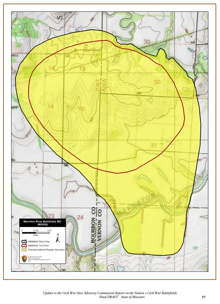
As part of their Update to the Civil War Sites Advisory Commission Report on the Nation s Civil War Battlefields: State of Missouri published in 2011, the National Park Service places the location of the Marmaton River Battlefield astride the Missouri/Kansas state line, west of Shiloh Creek [Waypoint = 37.872054 -94.615857]. Although not explicitly depicted, their map suggests the wagon train crossed just south of the battlefield.
Map of Marmaton River Battlefield (National Park Service)

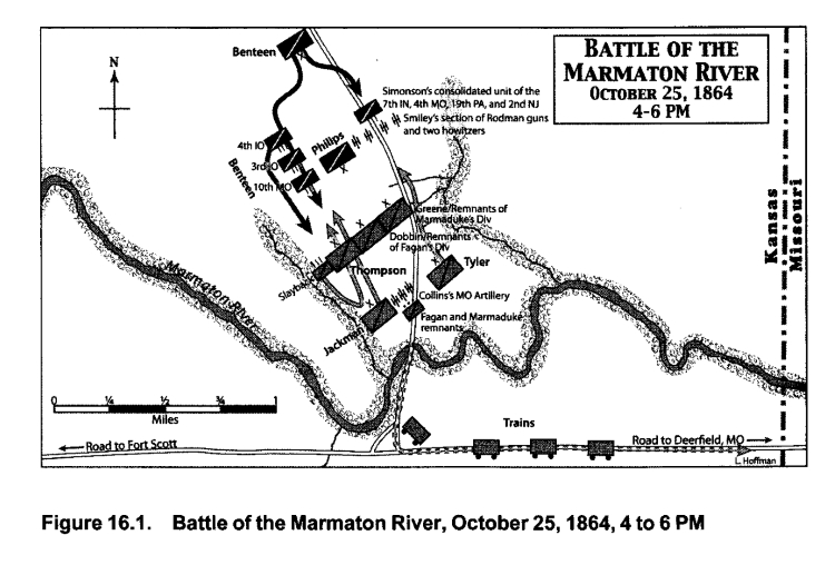
In 2015 Kyle Sinisi published a new book, The Last Hurrah: Sterling Price's Missouri Expedition of 1864, about Price's 1864 invasion of Missouri. In this book, Sinisi argues this engagement took place in Kansas, about one mile west of the Missouri/Kansas state line [Waypoint = 37.858856 -94.644612]. Sinisi’s map indicates Price’s wagon train crossed the Marmaton River just south of the battlefield.
Map of Marmaton River Battlefield (Kyle Sinisi)

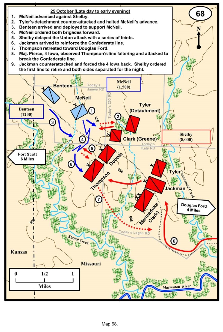
And this year, Charles D. Collins, Jr. of the Combat Studies Institute at Fort Leavenworth, Kansas, published the comprehensive Battlefield Atlas of Price’s Missouri Expedition of 1864. Collins agrees with the Missouri Department of Natural Resources analysis. Collins’s map indicates the battle took place in Missouri with Price’s wagon train using Douglas Ford to cross the Marmaton River.
Map of Marmaton River Battlefield (Charles D. Collins, Jr.)

You pick 'em.
Last changed: Sep 28 2016 at 1:18 PM
Back